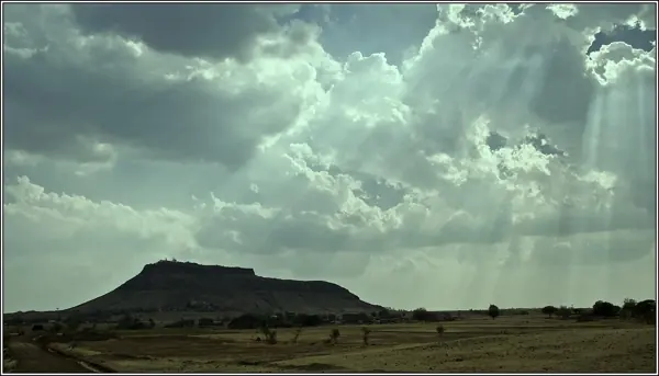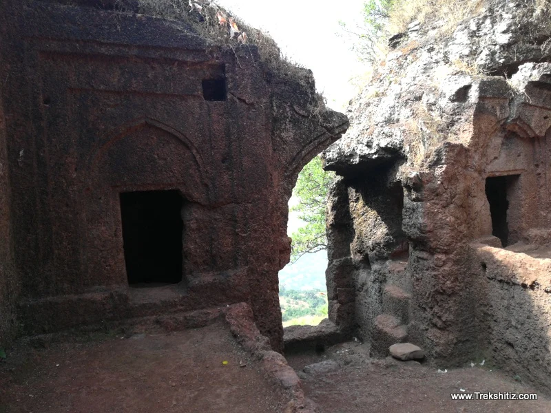
Dategad — documentary photograph

Satara / Hill fort

Dategad

A rock-cut gateway, sculpted deities and a deep stepped well reveal the engineering of this compact hill fort near Patan.

View 9 photographs ↘Documentary photograph
Trekshitiz photo archive; individual photographer not supplied · Original source · Used with permission confirmed by the site owner

YOUR EXPLORATION, AT A GLANCE

EasyRecommended

The source describes gateways, water tanks, offering a useful introduction to this fort’s architecture.

View on map ⌖

District
Satara
Base / nearby village
Tolewadi
Nearby city
Satara
Source elevation
Not documented

Closest among 11 listed regional hubs by straight-line distance; not road distance. 37 km to the listed city.

THE STORY BEHIND THE STONE

Why Dategad
matters.

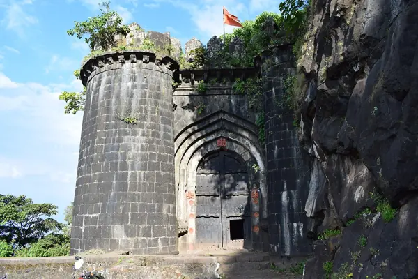
Dategad, also known as Sundargad, stands near Patan in Satara. The Maharashtra Gazetteer describes an oblong hilltop stronghold with a western entrance cut down through the rock. Steps turn towards the summit beside an image of Maruti. These surviving features show how the builders used the rock itself as part of the defensive approach.

A fort carved into the rock +

The Gazetteer records the fort’s surrender to Captain Grant in May 1818. Its account describes a negotiated exchange involving the commandant’s horses and permission for the garrison to retain its arms and property. The entrance, rock-cut water structures and sculpted deities make Dategad valuable for understanding everyday fort infrastructure as well as the end of Maratha control.

Research source: Maharashtra State Gazetteers — Satara: Dategad · Reviewed 2026-11-15

Rulers & historical periods +

Maratha

Recorded possession intervals may omit changes of control. Exact uninterrupted durations are not assumed from a ruler’s reign.
READING THE REMAINS

Architecture &
fort features.

Explore features described in the historical source. Their surviving condition and access can vary.

01Gateways +

Gateways is recorded in the linked account of Dategad. Explore the historical sources ↗

02Water tanks +

Water tanks is recorded in the linked account of Dategad. Explore the historical sources ↗

03Rock-cut entrance passage +

Rock-cut entrance passage is recorded in the linked account of Dategad. Explore the historical sources ↗

04Rock-cut steps +

Rock-cut steps is recorded in the linked account of Dategad. Explore the historical sources ↗

05Ganapati and Maruti sculptures +

Ganapati and Maruti sculptures is recorded in the linked account of Dategad. Explore the historical sources ↗

06Stepped well and water cisterns +

Stepped well and water cisterns is recorded in the linked account of Dategad. Explore the historical sources ↗

Feature inventory only. A surveyed top-down plan is not yet available in this guide.

KNOW THE APPROACH

Plan your
exploration.

Easy
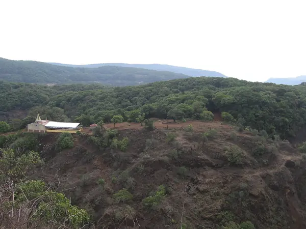
  • The documented approach includes a climb from Tolewadi and rock-cut steps. Uneven footing and the final ascent warrant care; the source grade is provisional.

The linked Trekshitiz guide describes an approach from Patan towards Tolewadi, followed by a climb to the fort. Confirm the current access road and path locally; the published approach timings are estimates.

Assessment & safety notes +

Approach described in the linked field guide. Provisional — source guide, current conditions unverified.

Check current local access and weather before travelling. Carry water, use established routes, and leave stonework undisturbed. A map pin identifies the monument, not a safe trailhead or landing point.

Source review: 2026-11-15. Stars describe route difficulty; recommendations are separate editorial judgements. No community review counts are displayed.

KEEP THE JOURNEY GOING

More of Satara.

All forts ↗
Research sources & image credits +
  1. Dategad — history, geographical facts and references ↗
  2. Trekshitiz — field guide and source trek information ↗
  3. Maharashtra State Gazetteers — Dategad near Patan, Satara ↗

Source review: 2026-11-15. Coordinates: Source-referenced.

Research approach and credits ↗