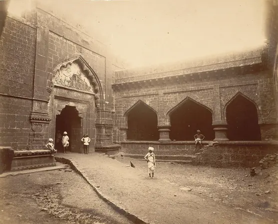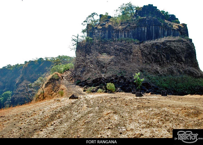
Rangana Fort — documentary photograph

Kolhapur / Hill fort

Rangana Fort

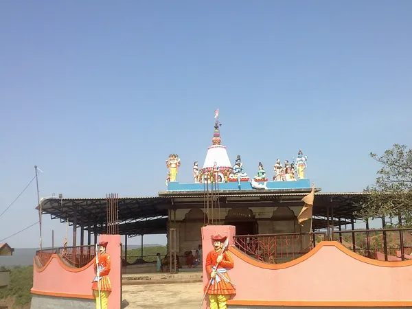
Successive gateways, fortified spurs, water tanks and the Ranganai shrine reveal the scale of this wooded Sahyadri stronghold.

View 9 photographs ↘Documentary photograph
Trekshitiz photo archive; individual photographer not supplied · Original source · Used with permission confirmed by the site owner

YOUR EXPLORATION, AT A GLANCE

Difficulty Not Yet VerifiedRecommended

The source describes temple remains, gateways, offering a useful introduction to this fort’s architecture.

View on map ⌖

District
Kolhapur
Base / nearby village
Chikkewadi; Narur is an alternative approach village
Nearby city
Kolhapur
Source elevation
2,227 ft (679 m)

Closest among 11 listed regional hubs by straight-line distance; not road distance. 81 km to the listed city.

THE STORY BEHIND THE STONE

Why Rangana Fort
matters.

This fort was built by the King Bhoj-II of the Shilahar dynasty in the 12th century. In 1470 this fort…

A short excerpt from the linked source account. A fuller editorial history is still being researched.

The historical source discusses Shivaji Maharaj; see the linked account for the specific episode.

Rulers & historical periods +

Adil Shahi / Bijapur, Portuguese, British / East India Company

Recorded possession intervals may omit changes of control. Exact uninterrupted durations are not assumed from a ruler’s reign.
READING THE REMAINS

Architecture &
fort features.

Explore features described in the historical source. Their surviving condition and access can vary.

01Temple remains +

Temple remains is recorded in the linked account of Rangana Fort. Explore the historical sources ↗

02Gateways +

Gateways is recorded in the linked account of Rangana Fort. Explore the historical sources ↗

Feature inventory only. A surveyed top-down plan is not yet available in this guide.

KNOW THE APPROACH

Plan your
exploration.

Difficulty Not Yet Verified
  • Reliable route evidence is insufficient for a numerical rating.

Detailed routes are not verified. Consult the source guide and confirm access locally.

Assessment & safety notes +

Not verified. Insufficient evidence.

Check current local access and weather before travelling. Carry water, use established routes, and leave stonework undisturbed. A map pin identifies the monument, not a safe trailhead or landing point.

Source review: 2026-11-15. Stars describe route difficulty; recommendations are separate editorial judgements. No community review counts are displayed.

KEEP THE JOURNEY GOING

More of Kolhapur.

All forts ↗
Research sources & image credits +
  1. Rangana Fort — history, geographical facts and references ↗
  2. Trekshitiz — Rangana (Marathi guide and photographs) ↗

Source review: 2026-11-15. Coordinates: Source-referenced.

Research approach and credits ↗