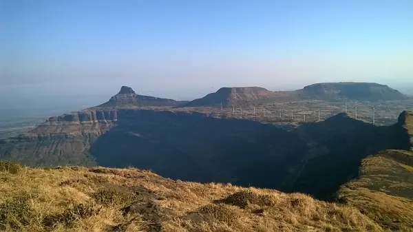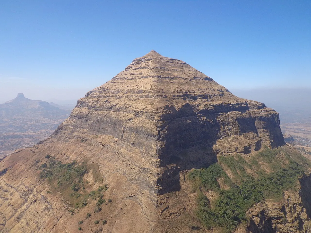
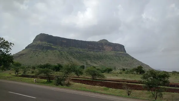
Salher — documentary photograph

Nashik / Hill fort

Salher

Salher dominates the Baglan region of northern Maharashtra.

View 6 photographs ↘Documentary photograph
Bhushan Kotakar · Original source · CC BY-SA 3.0

YOUR EXPLORATION, AT A GLANCE

ModerateMost Recommended

Its documented role in the Maratha fort network gives it exceptional educational and historical value.

View on map ⌖

District
Nashik
Base / nearby village
Not yet verified
Nearby city
Nashik
Source elevation
1,566 m (5,138 ft)

Closest among 11 listed regional hubs by straight-line distance; not road distance. 82 km to the listed city.

THE STORY BEHIND THE STONE

Why Salher
matters.

Salher dominates the Baglan region of northern Maharashtra. The major battle fought nearby in 1672 between Maratha and Mughal forces is an important event in the history of the Maratha military.

The historical source discusses Shivaji Maharaj; see the linked account for the specific episode.

Rulers & historical periods +

Mughal, Maratha, British / East India Company

Recorded possession intervals may omit changes of control. Exact uninterrupted durations are not assumed from a ruler’s reign.

A PLACE WITHIN THE LARGER STORY

Turning points.
1672
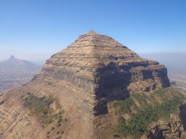
Salher — documentary photographExplore Salher ↗

The kingdom takes shape

Salher and a major field victory

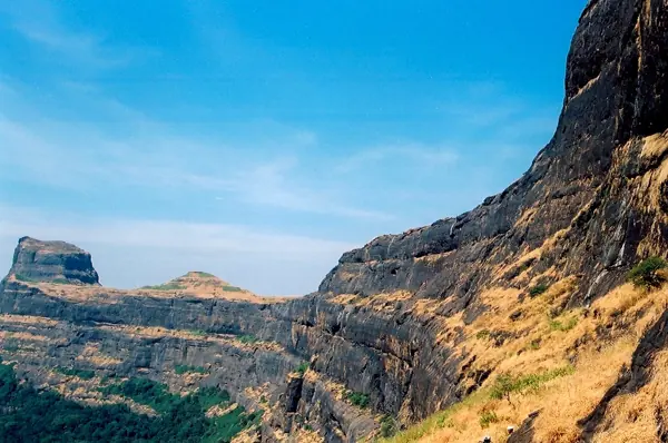
Salher stands in the Baglan region of present-day Nashik district. Maratha forces captured the fort in 1671. Mughal forces subsequently attempted to recover it. The campaign led to a major battle in 1672. Moropant Pingle and Prataprao Gujar are associated with the Maratha relief effort. The Maratha victory lifted the pressure on the besieged stronghold. It demonstrated capacity in open campaigning as well as fort defence. Baglan’s routes made the surrounding region strategically important. Salher’s story belongs to a network that includes neighbouring Mulher. Its importance does not depend on exaggerated troop or casualty figures.
Read full story

Salher’s commanding position in Baglan gave it a place in the contest for routes linking the northern Deccan and western India. Maratha forces captured the fort in 1671. Mughal attempts to recover it brought a siege and then a major confrontation in 1672. The successful Maratha relief is associated with the leadership of Moropant Pingle and Prataprao Gujar. The result secured the position at a significant moment in the expansion of Chhatrapati Shivaji Maharaj’s power.

The campaign is important because it broadens the familiar picture of Maratha warfare. Fortified heights and rapid movement were important, but the victory at Salher also involved substantial forces operating outside the fort. A garrison’s ability to hold a position and a relief army’s ability to reach it were related parts of the same operation. Reading only the walls would miss that wider battlefield and the routes through which supplies and troops moved.

Neighbouring strongholds, including Mulher, help place Salher within a regional system. Control of one hill did not automatically guarantee control of every valley or road. Garrisons, provisions and the ability to respond to an opposing army all mattered. This is why the region remained contested after individual victories and why possession dates must be distinguished from the date of a single battle.

Accounts of Salher sometimes offer very large totals for troops, prisoners or casualties. This guide does not repeat figures that have not been carefully reconciled across sources. The strategic result is clear without them: the Maratha forces overcame the besiegers and reinforced their position in Baglan. For visitors, the historical importance lies in the coordination required to turn a threatened stronghold into a successful regional operation, as well as in the exceptional landscape of the fort itself.

Salher ↗

Sources: Nashik Gazetteer — seventeenth-century campaigns, Nasik Presidency Gazetteer — Salher and Baglan, Battle of Salher — references and overview

READING THE REMAINS

Architecture &
fort features.

Explore features described in the historical source. Their surviving condition and access can vary.

01Rock-cut cisterns +

Rock-cut cisterns is recorded in the linked account of Salher. Explore the historical sources ↗

02Temple remains +

Temple remains is recorded in the linked account of Salher. Explore the historical sources ↗

03Gateways +

Gateways is recorded in the linked account of Salher. Explore the historical sources ↗

04Water tanks +

Water tanks is recorded in the linked account of Salher. Explore the historical sources ↗

Feature inventory only. A surveyed top-down plan is not yet available in this guide.

KNOW THE APPROACH

Plan your
exploration.

Moderate
  • The source assigns this grade but does not provide enough route detail to explain individual obstacles.

There are two major routes available to go to the fort.

Assessment & safety notes +

Approach described in the linked field guide. Provisional — source guide, current conditions unverified.

Check current local access and weather before travelling. Carry water, use established routes, and leave stonework undisturbed. A map pin identifies the monument, not a safe trailhead or landing point.

Source review: 2026-11-15. Stars describe route difficulty; recommendations are separate editorial judgements. No community review counts are displayed.

KEEP THE JOURNEY GOING

More of Nashik.

All forts ↗

MAHARASHTRA TOURISM · BROCHURE GUIDE

Salher: heritage & nearby places

Salher rises above the Baglan landscape and is presented as the highest fort in the Sahyadris. Its commanding views and association with conflicts during Chhatrapati Shivaji Maharaj’s reign make it important to the region’s military history.

Landmarks to look for

  • Parashuram Temple
  • Views of Salota
  • Salher hills
  • Sunrise and sunset viewpoints

Brochure activity ideas: Trekking, photography and stargazing where permitted.

Travel distances from the brochure

Distances are reproduced as brochure figures, not current measured routes. The brochure is undated. Confirm routes and access locally.

By air
Aurangabad 205 km
By rail
Manmad 95 km
By road
Manmad 94 km

Source clarification: Parashuram’s penance is a religious tradition. The brochure’s campfire/rock-climbing suggestions do not establish permission or safe conditions.

Adapted from Maharashtra Tourism, Guardians of History — The formidable forts of Maharashtra, PDF pages 8. Read the original PDF ↗ · Explore all brochure forts ↗

Research sources & image credits +
  1. Salher — history, geographical facts and references ↗
  2. Trekshitiz — field guide and source trek information ↗

Source review: 2026-11-15. Coordinates: Source-referenced.

Research approach and credits ↗