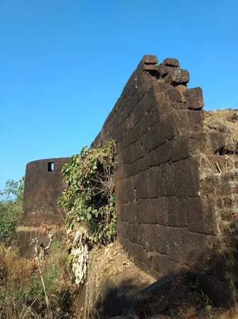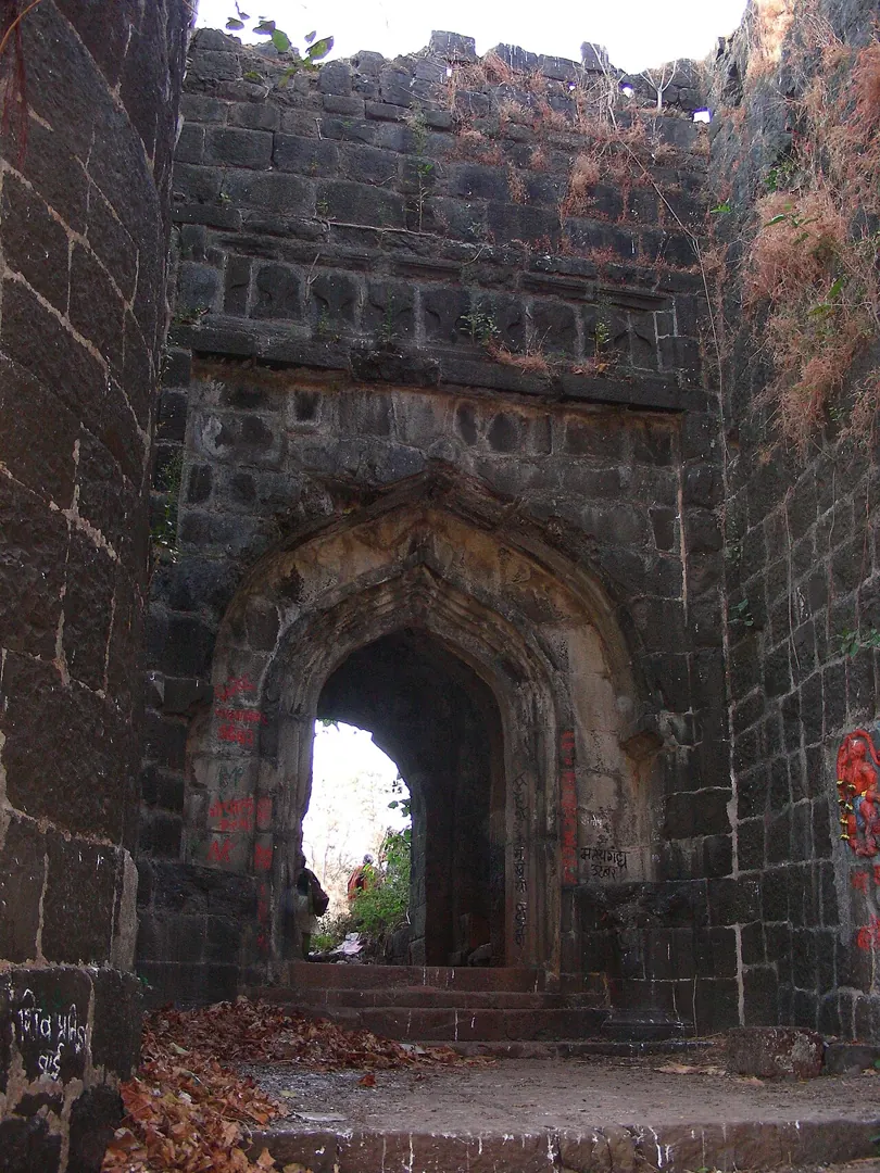
Suvarnadurg — documentary photograph

Ratnagiri / Sea fort

Suvarnadurg

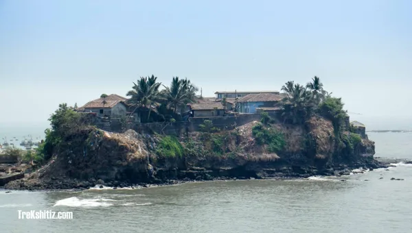
Suvarnadurg stands on an island near Harnai.

View 9 photographs ↘Documentary photograph
AshLin · Original source · CC BY-SA 3.0

YOUR EXPLORATION, AT A GLANCE

ModerateMost Recommended

Its documented role in the Maratha fort network gives it exceptional educational and historical value.

View on map ⌖

District
Ratnagiri
Base / nearby village
Not yet verified
Nearby city
Ratnagiri
Source elevation
Not documented

Closest among 11 listed regional hubs by straight-line distance; not road distance. 95 km to the listed city.

THE STORY BEHIND THE STONE

Why Suvarnadurg
matters.

Suvarnadurg stands on an island near Harnai. It became part of the Maratha coastal defence network and is associated with the naval power of the Angres. The fort illustrates the relationship between maritime routes and strong coastal positions.

The historical source discusses Shivaji Maharaj; see the linked account for the specific episode.

Rulers & historical periods +

Maratha, Siddi, British / East India Company

Recorded possession intervals may omit changes of control. Exact uninterrupted durations are not assumed from a ruler’s reign.

A PLACE WITHIN THE LARGER STORY

Turning points.
1664–1667
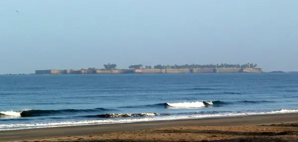
Sindhudurg Fort — documentary photographExplore Sindhudurg Fort ↗

The kingdom takes shape

Sindhudurg and the maritime vision of Swarajya

Chhatrapati Shivaji Maharaj recognised the strategic importance of the coast. Sindhudurg was built on an island off Malvan. Construction began in 1664 and continued until 1667. Hiroji Indulkar is associated with the work’s supervision. The island position made sea access part of its defence. Its walls and gateways were designed for a maritime setting. Coastal strongholds supported naval activity and the protection of shore routes. Vijaydurg, Suvarnadurg and Kolaba belonged to the wider maritime story. Later Maratha naval leaders continued to use and develop coastal bases. Sindhudurg shows that Swarajya’s strategic vision extended beyond the mountains.
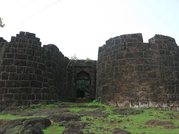
Read full story

Sindhudurg stands off Malvan on an island chosen for a major new coastal fortification under Chhatrapati Shivaji Maharaj. Construction began in 1664 and was completed in 1667. The undertaking is associated with the supervision of Hiroji Indulkar. Its scale and setting show the importance assigned to the western seaboard: the Maratha state sought to maintain a presence in a maritime world where local powers and European trading companies contested influence.

An island fort presented different problems from a hilltop stronghold. Materials and labour had to reach the site by water, and its garrison needed dependable supplies. The approaches from the sea, the placement of gateways and the relationship between the walls and surrounding rocks all formed part of the defensive setting. Sindhudurg therefore provides an opportunity to study engineering and logistics alongside the history of kings and campaigns.

The fort should also be read as one part of a longer coastline. Vijaydurg, Suvarnadurg and Kolaba had their own histories and did not all begin in the same construction programme. Together, however, these places reveal the development of bases from which coastal authority and naval activity could be maintained. Later Maratha naval leaders, including Kanhoji Angre and his successors, added another important chapter to that story.

The maritime vision did not remove rivalry or make every expedition successful. Coastal warfare involved changing alliances, difficult navigation and competing control of harbours and shipping. Recognising those complexities makes the achievement of building and maintaining Sindhudurg more understandable. For a visitor today, the fort’s importance lies in the connection it makes between Swarajya, the labour of coastal communities and the technical demands of defence at sea. Its heritage deserves the same care as the better-known mountain capitals.

Sindhudurg Fort ↗Vijaydurg Fort ↗Suvarnadurg ↗Kolaba Fort ↗

Sources: Maharashtra Tourism — Sindhudurg, Sindhudurg District — historical background, UNESCO — Maratha Military Landscapes, Sindhudurg Fort — references

READING THE REMAINS

Architecture &
fort features.

Explore features described in the historical source. Their surviving condition and access can vary.

01Bastions +

Bastions is recorded in the linked account of Suvarnadurg. Explore the historical sources ↗

02Gateways +

Gateways is recorded in the linked account of Suvarnadurg. Explore the historical sources ↗

03Granaries +

Granaries is recorded in the linked account of Suvarnadurg. Explore the historical sources ↗

04Moat +

Moat is recorded in the linked account of Suvarnadurg. Explore the historical sources ↗

05Palace remains +

Palace remains is recorded in the linked account of Suvarnadurg. Explore the historical sources ↗

06Water tanks +

Water tanks is recorded in the linked account of Suvarnadurg. Explore the historical sources ↗

Feature inventory only. A surveyed top-down plan is not yet available in this guide.

KNOW THE APPROACH

Plan your
exploration.

Moderate
  • Access includes a boat crossing; this is separate from walking difficulty.

From Mumbai one can reach Murud Harne which is 15 kms via Dapoli. The only approach to the fort is by boats, from Harnai. Boats have to be arranged through the local fishermen. The nearest railway station on the Konkan Railway of the Indian Railways is at Khed.

Assessment & safety notes +

Approach described in the linked field guide. Provisional — source guide, current conditions unverified.

Check current local access and weather before travelling. Carry water, use established routes, and leave stonework undisturbed. A map pin identifies the monument, not a safe trailhead or landing point.

Source review: 2026-11-15. Stars describe route difficulty; recommendations are separate editorial judgements. No community review counts are displayed.

KEEP THE JOURNEY GOING

More of Ratnagiri.

All forts ↗

MAHARASHTRA TOURISM · BROCHURE GUIDE

Suvarnadurg: heritage & nearby places

Suvarnadurg is an island sea fort near Harnai on the Konkan coast. Its relationship with the nearby Kanakadurga land fort helps explain the layered coastal defences associated with the Maratha navy.

Landmarks to look for

  • Island ramparts
  • Kanakadurga coastal fort

Places in the wider area

  • Harnai fish auction
  • Ganpati Temple, Anjarle
  • Yakub Baba Dargah, Kelshi
  • Murud Beach, Dapoli
  • Karde Beach
  • Ladghar Beach
  • Keshavraj Temple, Asud
  • Parshuram statue, Burondi
  • Chandika Devi Temple, Dabhol
  • Dabhol Fort
  • Panhalekaji Caves
Travel distances from the brochure

Distances are reproduced as brochure figures, not current measured routes. The brochure is undated. Confirm routes and access locally.

By air
Pune 220 km; Mumbai 240 km; Mopa 336 km
By rail
Khed 44 km
By road
Dapoli bus stand 13 km; Mumbai 337 km

Source clarification: The brochure dates the capture to 1660; this has not been used to overwrite the existing chronology. Confirm current boat access locally.

Adapted from Maharashtra Tourism, Guardians of History — The formidable forts of Maharashtra, PDF pages 6. Read the original PDF ↗ · Explore all brochure forts ↗

Research sources & image credits +
  1. Suvarnadurg — history, geographical facts and references ↗
  2. Trekshitiz — field guide and source trek information ↗

Source review: 2026-11-15. Coordinates: Source-referenced.

Research approach and credits ↗